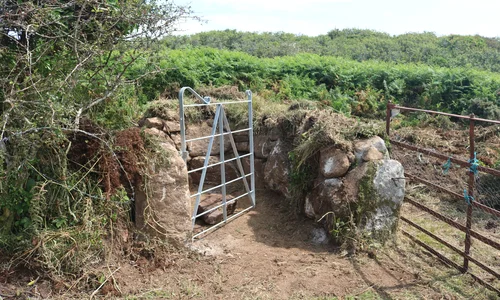
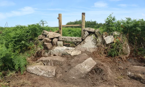
 Mulfra Vean is a prehistoric settlement, originally Bronze Age roundhouses, converted in the Iron Age to courtyard houses. There are the remains of at least four courtyard houses and earlier roundhouses, straddling a hedged lane. Doing something to enable public access to the settlement on either side of the lane (a Public Bridleway) has been an aspiration for PLP and CASPN since our very first volunteer sessions as a partnership back in late summer 2018. Since then we’ve returned multiple times to maintain the vegetation, and a detailed archaeological survey of the site has been carried out by our volunteers.
To access the courtyard houses in the western side of the site, a section of Cornish hedge has been sensitively rebuilt to accommodate a pedestrian “Penwith” kissing gate adjacent to an existing field gate. On the east side, large granite slabs form steps off the bridleway up to the boundary hedge, and then a granite stile had been built into the hedge. The work was subject to Scheduled Monument Consent, and PLP Archaeologist Laura carried out a Watching Brief over the more sensitive elements of the job. The structures are intended to be entirely in-keeping with the landscape, working with local granite. The hope being that in a year from now, you’d mistake the stones for having been there for hundreds of years.

Thank you to the Olds family for allowing us to work on their land, and for permitting public access to this wonderful archaeological site. And to Pip Morse, for doing such a brilliant job!
We’re looking to get our volunteers back here again very soon - it’s ready for another scything. We have a trail guide to go on the website for this area in the near future, and we’re looking to commission and install a small interpretation panel somewhere at the site itself, visible from the lane.
CLICK HERE TO SEE MORE PHOTOGRAPHS
How to get there
 Nearest parking is by Trye Primary School - outside of school start/finish times, there’s a good wide bit along the road there that usually has room to park. A footpath heads across the fields from there towards Mulfra, joining the lane a little way up. Go this way if you’re OK with stiles and the chance to get your feet wet (and see a nice granite footbridge), otherwise follow the road downhill and then turn left up the lane to Mulfra. Follow the track through the hamlet, at the top it becomes a bridleway through a narrow and ancient lane. A short way up the lane, a path forks off to the left, with an old (and beautiful) Penwith gate the top. The western side of the settlement is in here, and the eastern side can be accessed a little further up the lane – look for the granite slab steps off to the right.
Alternatively, you can come up and over Mulfra Hill from the northern side, parking near the top of the Trye Valley, near the Gurnards Head/Zennor junction. There are a couple of routes up or around the hill. Going over the top takes you past Mulfra Quoit (and provides one of the best views of Mounts Bay) – from there take the path that heads straight down the hill towards the bay. You’ll eventually come down into the lane, and the settlement part way down.


