First and Last – Our Living Working Landscape
Gydlavar dhe Lergh: Troyl Men an Toll
Trail Guide: Mên-an-Tol Circular
A walk that includes two of Penwith's most popular ancient sites: the Mên-an-Tol, and Lanyon Quoit. Rather than just visiting them in isolation as many do, you can include them both in a circular route that also takes in the Nine Maidens Stone Circle, Ding Dong mine, the Bosiliack Entrance Grave, as well as the lesser known Bosiliack round house settlement. It's a fascinating route to appreciate the many layers of history over the landscape, from the prehistoric right through to 19th century mining activity.
|
Distance: |
3 miles / 4.8km (core loop) |
|
Time: |
Allow at least 3 hours |
|
Starting grid reference: |
SW 418 344 |
|
Public Transport: |
The nearest you can get by public transport at present is Morvah (2km to start point) or Madron (3km to Lanyon Quoit) |
|
Car Parking: |
There is a small car parking area at the start point of the route. When busy, the verge just downhill from the car park is wide enough to accommodate cars (be mindful of large tractors needing to pass, and hidden ditches). |
|
Nearest Facilities |
Morvah Schoolhouse and Cafe (1.5miles) |
|
Accessibility & Terrain info |
Cattle grazed in Mên-an-Tol area. Route features granite stiles and passes in vicinity of mine shafts. Gradual climb with one steep section. Short section on public road. |
|
Safety info & disclaimer: |
|
|
Downloadable PDF: |

Route Instructions:
1. |
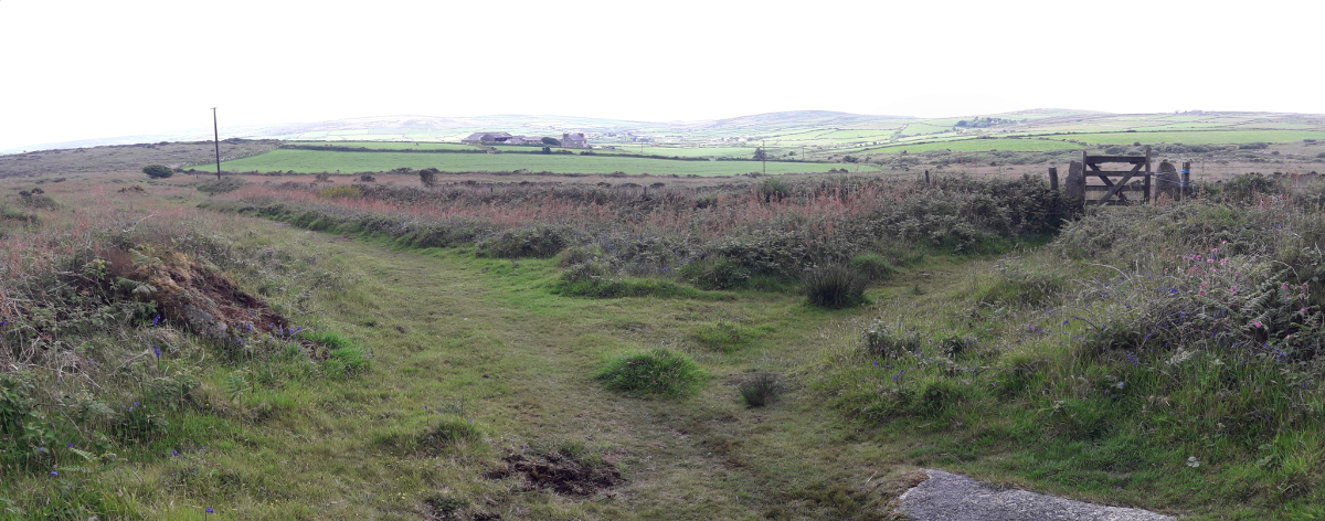
Starting from the roadside parking area by Bosullow, go through the gate and follow up the track.
|
|
|
2. |
The track passes by the farm buildings and field systems of Little Higher Bosullow. Continue heading up the lane. |
Little Higher Bosullow and Coronation House - a farmstead established on the edge of the moor in the early 20th Century, before the 1908 Ordnance Survey; the “Coronation” likely to have been that of Edward VII (West Penwith Surveys). The lane, although much older, has been given the same name. There are Bronze Age Hut Circles within the fields, suggesting the area had been occupied for much longer.
|
|
3. |
At this point, cross the stone stile in the hedge on your right, and walk a short way across the moorland to the Mên-an-Tol. Retrace your steps to the lane, or see 3a for a shorter loop from here.
|
Late Neolithic / Early Bronze age (2500-1500BC) - a holed stone, two upright stones and further fallen stones; the remains of a stone circle. See CASPN page for more information. Note cattle are often grazed in this area
|
|
3a. |
The footpath continues from the Mên-an-Tol, crossing a small stream then gradually climbing up towards Greenburrow Engine House (point 10).
|
The line of the Public Right of Way that crosses the moor here, as mapped in green dashes on the Ordnance Survey, appears to be a very old line and no longer in active use. The "used" line is slightly further to the south, and appears on the OS as a small black dashed line.
|
|
4. |
Continuing up Coronation Lane, at this point, look through the field opening to your left, to the Mên Scryfa.
|
Mên Scryfa - a 6ft Bronze Age standing stone, with a 5th or 6th century AD inscription on the northern face. See CASPN page for more information.
|
|
5. |
Here the lane opens out. Continue straight ahead along the track. On your right, is a Penwith-type field gate; for a small detour to visit Fenton Bebibell Well, go through this gate. Otherwise, carry on to the crossing of tracks up ahead.
|
The track forking back to the left at this point, into "Jeraw Lane" . It is considered to be part of the route of the Tinners' Way. Probably a contraction of "Hewcherow", being the name of a croft recorded to the north c. 1841. Likely hewos, havos, "shieling, summer pasture" + erow "acre" (Craig Weatherhill)
|
|
6. |
At the junction, go straight across, ignoring the trackways branching left and right. Ahead, just off the east side of the crossing is a low flat stone set into the ground; this is the Four Parishes stone. Past this, the path forks; the left fork is the line of the Tinners' Way, while the right hand path climbs the small hill ahead and onto the main ridge of Nine Maidens Common. Take this right hand path.
|
The Four Parishes Stone, or Men Crows (men, "stone" + crows, "cross"). An elongated natural boulder with a small incised cross, which marked the meeting point of four ecclesiastical parishes (CW). The track heading up to the left (north) is the drove road heading over the ridge between the visually prominent Carn Galva, and the less so, but slightly higher, Watch Croft. The path climbing onto the common is short, but deeply gullied and steep in parts - watch your footing!
|
|
7. |
As the path levels out onto the broad ridge, look for a low cairn on the summit immediately to your right, well worth stopping to admire the view. Continue along the now broad path across the ridge, south towards the stone circle.
|
A set of raised Bronze Age cairns all appear aligned to Carn Galva. Perhaps intentionally placed, as a platform on which groups of people could appreciate important landscape features (West Penwith Surveys) A fantastic area of moorland habitat; In winter time, a chance that Hen Harriers and Short Eared Owls might be in the area. Look for abundance of yellow Tormentil flowers on the heath in summer; and the rare Tormentil Mining Bee Andrena Tarsata
|
|
8. |
Take some time to stop at the Nine Maidens Stone Circle, just to the left of the path at this point. When ready, return to the path heading south.
|
Bronze Age stone circle; the two largest stones placed so that they frame the outcrop of Carn Galva when viewed from the centre of the circle (West Penwith Surveys) See CASPN page for more information 
|
|
9. |
There is another Bronze Age barrow, this one obviously kerbed, just off to the left of the main path. Once ready, continue along the main path. More of Mounts Bay becomes visible as you proceed. The path crosses a couple of field boundaries, before ultimately coming out onto the Ding Dong Track.
|
Coming into the heavily mined landscape around Ding Dong. Avoid straying from the established paths, there are many pits and holes hidden under the heather and gorse.
|
|
10. |
Upon reaching the main track, turn right and follow the track, heading towards the obvious landmark of Greenburrow Engine House.
|
|
|
11. |
Shortly before the engine house, you reach a large junction of tracks. It's useful to orientate yourself at this point! Take the smaller path that heads past the left of the engine house.
|
Ding Dong Mine, an extensive mining area, worked during the 19th Century, but believed to be much older. Greenburrow Engine House, built in 1865, is a fantastic viewpoint from which to see the surrounding mined landscape and beyond.
|
|
11a. |
From point 11, the built track continues south off the moor, down a narrow and clearly very old lane, and onto the road near Bosiliack Farm. There is a parking space at this point, which can be used as an alternate start/finish point for this walk.
|
Bosiliack Menhir - a standing stone in the hedge in the lane here, backing onto the reservoir. Clearly visible on the left of the lane walking up from the parking spot.
|
|
12. |
Just below the engine house, a public footpath line leaves the track, crosses a stile, and heads downhill to the west through an undulating landscape of mine spoil and pits. Follow the footpath to the gate and stile at the bottom, and cross over.
|
|
|
13. |
Over the stile, there is a junction of paths. Straight ahead leads towards the Bosiliack Settlement. To the left, a path crosses the moor to Lanyon Quoit. A short way down this left hand path is the Bosiliack Entrance Grave - worth visiting either way you take.
|
Bosiliack Entrance Grave - an entrance grave or chambered tomb, dating from the Neolithic Period (3000-2500 BC). See CASPN page for more information.
|
|
13a. |
The left hand path from (13) meanders down the edge of some rough ground, before opening on the edge of a large flat area of bogland. A boundary hedge skirts the edge of the bog; the path follows around the outside of this hedge, before crossing through it, then ascends gently to Lanyon Quoit.
|
Probably the best known of West Cornwall's prehistoric monuments - but also one of the least authentic, having been re-erected incorrectly in the early 19th century. See CASPN page for more information. The Quoit is right next to the road, and many people that visit it do so from the road, rarely exploring further into the landscape from this point. This trail guide shows some of the many options for exploring the wider area.
|
|
14. |
Continuing straight from (13), after a short way the wide path bends to the left, and a timber gate in the fence in front of you just off the bend. Go through the gate, and out onto a much rougher area of moorland. The public footpath line heads straight down the hill.
|
|
|
14a. |
Instead of going through the gate, you can head straight out to the road by carrying along the path after it bends to the left, and follow it as it loosely hugs the field boundary on the right. You come to a gate into a narrow lane - at the end of the lane, you reach the road just above Lanyon Farm. To return to the start, turn right and follow the road.
|
***Until the public footpath at point 16 is improved, we recommending using this route to return to the road***
|
|
15. |
At this point, notice a low boundary hedge heading off to the right. Follow a rough path on the near side of this hedge a short way, to come to the settlement of Bosiliack.
|
Bosiliack Settlement - a Bronze Age roundhouse settlement, thirteen or more stone walled houses surviving as low stony walls.
|
|
16. |
Return to the path at (15), and continue west to the lower corner of the moor. You reach a ford, clearly used more by cattle than people; at this point, the line of the footpath actually continues along the southern bank of the stream a short way, crosses the stream, up the other side to a gate in the boundary, and out to the road. Turn right and follow the road back to the start.
|
The whole area of moorland we've walked around drains into this one boggy section of valley; it is the main source of the Drift catchment. NOTE this lower section of footpath is currently very challenging to use - We are hoping to help with this very soon - in the meantime, we recommend using (14a) as the route back to the road.
|